
Thank you for supporting this site ❤️
Make a donation
Make a donation
Eberbach topographic map
Click on the map to display elevation.
Thank you for supporting this site ❤️
Make a donation
Make a donation
Eberbach
Eberbach lies at the foot of the Katzenbuckel, at 626 m the highest elevation in the Odenwald, in the Naturpark Neckartal-Odenwald, on the romantic Burgenstraße (Castle Road) along the river Neckar.
Thank you for supporting this site ❤️
Make a donation
Make a donation
About this map
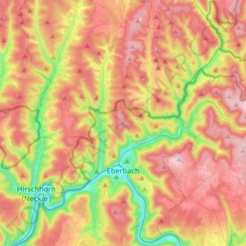
Name: Eberbach topographic map, elevation, terrain.
Average elevation: 372 m
Minimum elevation: 115 m
Maximum elevation: 614 m
Thank you for supporting this site ❤️
Make a donation
Make a donation