
Bazarne topographic map
Interactive map
Click on the map to display elevation.
About this map
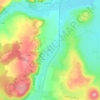
Name: Bazarne topographic map, elevation, terrain.
Average elevation: 221 m
Minimum elevation: 167 m
Maximum elevation: 294 m
Other topographic maps
Click on a map to view its topography, its elevation and its terrain.
Chivres
France > Bourgogne-Franche-Comté > Nièvre > Courcelles
Chivres, Courcelles, Clamecy, Nièvre, Bourgogne-Franche-Comté, France métropolitaine, 58210, France
Average elevation: 226 m
Courcelles
France > Bourgogne-Franche-Comté > Nièvre > Courcelles
Courcelles, Clamecy, Nièvre, Bourgogne-Franche-Comté, France métropolitaine, 58210, France
Average elevation: 237 m