
Waiakea Uka Park topographic map
Interactive map
Click on the map to display elevation.
About this map
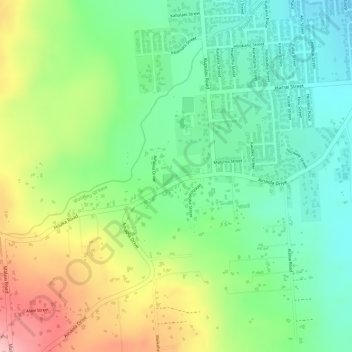
Name: Waiakea Uka Park topographic map, elevation, terrain.
Average elevation: 210 m
Minimum elevation: 145 m
Maximum elevation: 306 m
Other topographic maps
Click on a map to view its topography, its elevation and its terrain.
Rainbow Falls
United States > Hawaii > Hawaiʻi County > Hilo CDP
Rainbow Falls, Hilo CDP, Hawaiʻi County, Hawaii, 96720, United States
Average elevation: 136 m