
Thank you for supporting this site ❤️
Make a donation
Make a donation
Al Qubeiba topographic map
Click on the map to display elevation.
Thank you for supporting this site ❤️
Make a donation
Make a donation
About this map
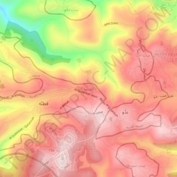
Name: Al Qubeiba topographic map, elevation, terrain.
Location: Al Qubeiba, Area B, West Bank, Palestinian Territory (31.82030 35.11715 31.86030 35.15715)
Average elevation: 738 m
Minimum elevation: 457 m
Maximum elevation: 875 m
Thank you for supporting this site ❤️
Make a donation
Make a donation
Other topographic maps
Click on a map to view its topography, its elevation and its terrain.