
Thank you for supporting this site ❤️
Make a donation
Make a donation
Dalukaana topographic map
Click on the map to display elevation.
Thank you for supporting this site ❤️
Make a donation
Make a donation
About this map
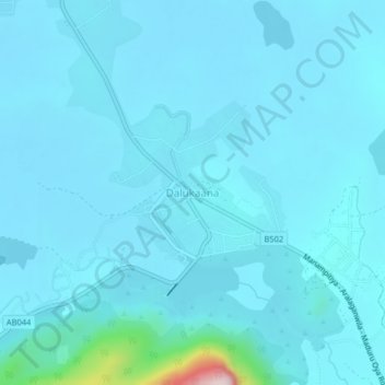
Name: Dalukaana topographic map, elevation, terrain.
Average elevation: 62 m
Minimum elevation: 35 m
Maximum elevation: 445 m
Thank you for supporting this site ❤️
Make a donation
Make a donation
Other topographic maps
Click on a map to view its topography, its elevation and its terrain.
Hurulu Wewa Project Canel
Sri Lanka > North Central Province > Huruluwewa Left
Average elevation: 127 m
Thank you for supporting this site ❤️
Make a donation
Make a donation
Kaludiya Pokuna
Sri Lanka > North Central Province > Mihintale > Illuppukanniya
Average elevation: 123 m