
Thank you for supporting this site ❤️
Make a donation
Make a donation
Albany Hill topographic map
Click on the map to display elevation.
Thank you for supporting this site ❤️
Make a donation
Make a donation
About this map
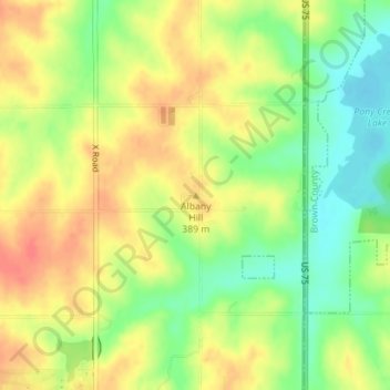
Name: Albany Hill topographic map, elevation, terrain.
Location: Albany Hill, Nemaha County, Kansas, United States (39.93689 -95.79809 39.93699 -95.79799)
Average elevation: 377 m
Minimum elevation: 349 m
Maximum elevation: 400 m
Thank you for supporting this site ❤️
Make a donation
Make a donation
Other topographic maps
Click on a map to view its topography, its elevation and its terrain.