Jackson Hole topographic map
Interactive map
Click on the map to display elevation.
About this map
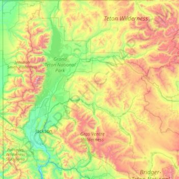
Name: Jackson Hole topographic map, elevation, terrain.
Location: Jackson Hole, Wyoming, United States (43.23474 -111.03923 44.13325 -110.05103)
Average elevation: 2,533 m
Minimum elevation: 1,770 m
Maximum elevation: 4,168 m
Other topographic maps
Click on a map to view its topography, its elevation and its terrain.
Yellowstone National Park
Yellowstone National Park spans an area of 3,468.4 sq mi (8,983 km2), with lakes, canyons, rivers, and mountain ranges. Yellowstone Lake is one of the largest high-elevation lakes in North America and is centered over the Yellowstone Caldera, the largest super volcano on the continent. The caldera is…
Average elevation: 2,450 m