
Καλλιθέα topographic map
Interactive map
Click on the map to display elevation.
About this map
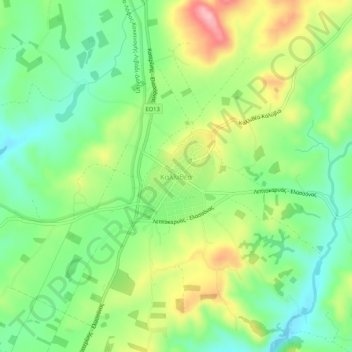
Name: Καλλιθέα topographic map, elevation, terrain.
Average elevation: 506 m
Minimum elevation: 443 m
Maximum elevation: 606 m
Other topographic maps
Click on a map to view its topography, its elevation and its terrain.
Όλυμπος
Griechenland > Thessalien - Mittelgriechenland > Regionalbezirk Larisa > Elassona
Όλυμπος, Elassona, Regionalbezirk Larisa, Region Thessalien, Thessalien - Mittelgriechenland, Griechenland
Average elevation: 2,456 m