
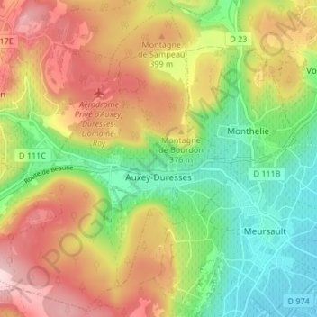
Auxey-Duresses topographic map
Interactive map
Click on the map to display elevation.
About this map
Name: Auxey-Duresses topographic map, elevation, terrain.
Average elevation: 340 m
Minimum elevation: 223 m
Maximum elevation: 478 m
Other topographic maps
Click on a map to view its topography, its elevation and its terrain.
Petit-Auxey
France > Bourgogne-Franche-Comté > Côte-d'Or > Auxey-Duresses
Petit-Auxey, Auxey-Duresses, Beaune, Côte-d'Or, Bourgogne-Franche-Comté, France métropolitaine, 21190, France
Average elevation: 354 m