
Vilcacoto topographic map
Interactive map
Click on the map to display elevation.
About this map
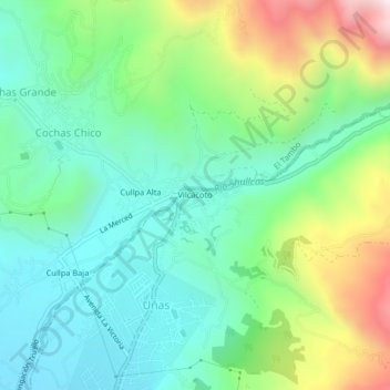
Name: Vilcacoto topographic map, elevation, terrain.
Location: Vilcacoto, Huancayo, Junín, 12002, Perú (-12.03315 -75.20148 -11.99315 -75.16148)
Average elevation: 3,596 m
Minimum elevation: 3,335 m
Maximum elevation: 4,198 m
Other topographic maps
Click on a map to view its topography, its elevation and its terrain.