
East Merrimack topographic map
Interactive map
Click on the map to display elevation.
About this map
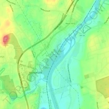
Name: East Merrimack topographic map, elevation, terrain.
Average elevation: 55 m
Minimum elevation: 23 m
Maximum elevation: 107 m
Other topographic maps
Click on a map to view its topography, its elevation and its terrain.
Reeds Ferry
United States > New Hampshire > Hillsborough County > Merrimack
Reeds Ferry, Merrimack, Hillsborough County, New Hampshire, 03054, United States
Average elevation: 58 m