
Thank you for supporting this site ❤️
Make a donation
Make a donation
Field Creek topographic map
Click on the map to display elevation.
Thank you for supporting this site ❤️
Make a donation
Make a donation
About this map
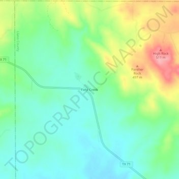
Name: Field Creek topographic map, elevation, terrain.
Location: Field Creek, Llano County, Texas, 76869, United States (30.88156 -98.96505 30.92156 -98.92505)
Average elevation: 448 m
Minimum elevation: 411 m
Maximum elevation: 521 m
Thank you for supporting this site ❤️
Make a donation
Make a donation
Other topographic maps
Click on a map to view its topography, its elevation and its terrain.