
Thank you for supporting this site ❤️
Make a donation
Make a donation
Marshfield topographic map
Click on the map to display elevation.
Thank you for supporting this site ❤️
Make a donation
Make a donation
About this map
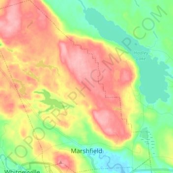
Name: Marshfield topographic map, elevation, terrain.
Location: Marshfield, Washington County, Maine, United States (44.72200 -67.54995 44.80936 -67.43240)
Average elevation: 51 m
Minimum elevation: -3 m
Maximum elevation: 109 m
Thank you for supporting this site ❤️
Make a donation
Make a donation
Other topographic maps
Click on a map to view its topography, its elevation and its terrain.