
Thank you for supporting this site ❤️
Make a donation
Make a donation
Forestdale topographic map
Click on the map to display elevation.
Thank you for supporting this site ❤️
Make a donation
Make a donation
About this map
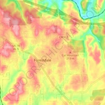
Name: Forestdale topographic map, elevation, terrain.
Location: Forestdale, Jefferson County, Alabama, 35214, United States (33.54828 -86.93473 33.59994 -86.86783)
Average elevation: 185 m
Minimum elevation: 118 m
Maximum elevation: 230 m
Thank you for supporting this site ❤️
Make a donation
Make a donation
Other topographic maps
Click on a map to view its topography, its elevation and its terrain.