
大红沟村 topographic map
Interactive map
Click on the map to display elevation.
About this map
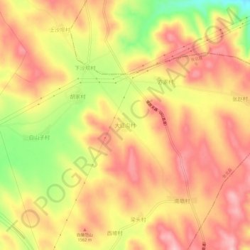
Name: 大红沟村 topographic map, elevation, terrain.
Location: 大红沟村, 张家口市, 河北省, 中国 (41.16804 115.01037 41.20804 115.05037)
Average elevation: 1,535 m
Minimum elevation: 1,430 m
Maximum elevation: 1,596 m
Other topographic maps
Click on a map to view its topography, its elevation and its terrain.