
Thank you for supporting this site ❤️
Make a donation
Make a donation
Cahone topographic map
Click on the map to display elevation.
Thank you for supporting this site ❤️
Make a donation
Make a donation
About this map
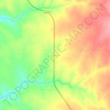
Name: Cahone topographic map, elevation, terrain.
Location: Cahone, Dolores County, Colorado, 81320, United States (37.63888 -108.82788 37.67888 -108.78788)
Average elevation: 2,037 m
Minimum elevation: 1,976 m
Maximum elevation: 2,086 m
Thank you for supporting this site ❤️
Make a donation
Make a donation
Other topographic maps
Click on a map to view its topography, its elevation and its terrain.