
Thank you for supporting this site ❤️
Make a donation
Make a donation
Yorktown topographic map
Click on the map to display elevation.
Thank you for supporting this site ❤️
Make a donation
Make a donation
About this map
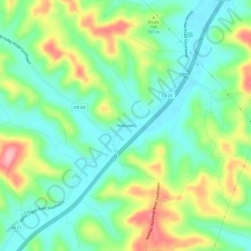
Name: Yorktown topographic map, elevation, terrain.
Location: Yorktown, Tuscarawas County, Ohio, United States (40.42673 -81.53540 40.46673 -81.49540)
Average elevation: 306 m
Minimum elevation: 261 m
Maximum elevation: 390 m
Thank you for supporting this site ❤️
Make a donation
Make a donation
Other topographic maps
Click on a map to view its topography, its elevation and its terrain.