
Thank you for supporting this site ❤️
Make a donation
Make a donation
Latur topographic map
Click on the map to display elevation.
Thank you for supporting this site ❤️
Make a donation
Make a donation
About this map
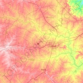
Name: Latur topographic map, elevation, terrain.
Location: Latur, Maharashtra, India (18.27793 76.20242 18.57629 76.74924)
Average elevation: 628 m
Minimum elevation: 527 m
Maximum elevation: 702 m
Thank you for supporting this site ❤️
Make a donation
Make a donation
Other topographic maps
Click on a map to view its topography, its elevation and its terrain.