
Villerach topographic map
Interactive map
Click on the map to display elevation.
About this map
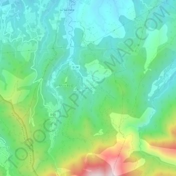
Name: Villerach topographic map, elevation, terrain.
Average elevation: 563 m
Minimum elevation: 357 m
Maximum elevation: 1,116 m
Other topographic maps
Click on a map to view its topography, its elevation and its terrain.
Clara
France > Occitanie > Pyrénées-Orientales > Clara-Villerach
Clara, Clara-Villerach, Prades, Pyrénées-Orientales, Occitanie, France métropolitaine, 66500, France
Average elevation: 689 m