Geolocate

Lone Rock Beach topographic map

Interactive map

Click on the map to display elevation.

About this map

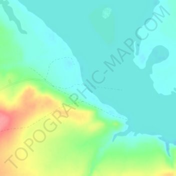
Name: Lone Rock Beach topographic map, elevation, terrain.

Location: Lone Rock Beach, Kane County, Utah, United States (37.01548 -111.53808 37.01558 -111.53798)

Average elevation: 1,134 m

Minimum elevation: 1,111 m

Maximum elevation: 1,195 m

Other topographic maps

Click on a map to view its topography, its elevation and its terrain.

Long Valley Junction

United States > Utah > Kane County

Long Valley Junction, Kane County, Utah, 84710, United States

Average elevation: 2,295 m

Navajo Lake

United States > Utah > Kane County > Navajo Lake Lodge

Navajo Lake, Navajo Lake Lodge, Kane County, Utah, United States

Average elevation: 2,851 m

Duck Creek Village

United States > Utah > Kane County

Duck Creek Village, Kane County, Utah, 84762, United States

Average elevation: 2,608 m

Coyote Gulch

United States > Utah > Kane County

Coyote Gulch, Kane County, Utah, United States

Average elevation: 1,361 m

Spooky Gulch

United States > Utah > Kane County

Spooky Gulch, Kane County, Utah, United States

Average elevation: 1,472 m

Cottonwood Point

United States > Utah > Kane County

Cottonwood Point, Kane County, Utah, United States

Average elevation: 1,641 m