
Thank you for supporting this site ❤️
Make a donation
Make a donation
Bristol topographic map
Click on the map to display elevation.
Thank you for supporting this site ❤️
Make a donation
Make a donation
About this map
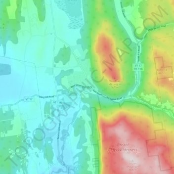
Name: Bristol topographic map, elevation, terrain.
Location: Bristol, Addison County, Vermont, United States (44.09327 -73.11852 44.17327 -73.03852)
Average elevation: 267 m
Minimum elevation: 95 m
Maximum elevation: 699 m
Thank you for supporting this site ❤️
Make a donation
Make a donation