
利川市 topographic map
Interactive map
Click on the map to display elevation.
About this map
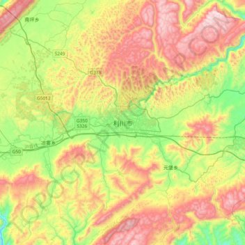
Name: 利川市 topographic map, elevation, terrain.
Location: 利川市, Prefectura autónoma tujia y miao de Enshi, Hubei, China (30.13374 108.77229 30.45374 109.09229)
Average elevation: 1,293 m
Minimum elevation: 836 m
Maximum elevation: 1,873 m