
Zourva topographic map
Interactive map
Click on the map to display elevation.
About this map
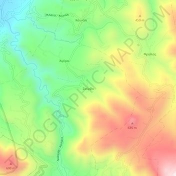
Name: Zourva topographic map, elevation, terrain.
Average elevation: 348 m
Minimum elevation: 11 m
Maximum elevation: 764 m
Other topographic maps
Click on a map to view its topography, its elevation and its terrain.
Νισπήτας
Griechenland > Region Kreta > Regionalbezirk Lasithi > Neapoli
Νισπήτας, Gemeinde Neapolis, Neapoli, Provinz Agios Nikolaos, Regionalbezirk Lasithi, Region Kreta, 721 00, Griechenland
Average elevation: 414 m