
赤海村 topographic map
Interactive map
Click on the map to display elevation.
About this map
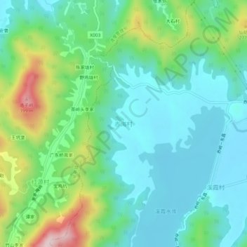
Name: 赤海村 topographic map, elevation, terrain.
Location: 赤海村, 溪霞镇, 新建区, 南昌市, 江西省, 中国 (28.83083 115.77335 28.87083 115.81335)
Average elevation: 130 m
Minimum elevation: 29 m
Maximum elevation: 411 m
Other topographic maps
Click on a map to view its topography, its elevation and its terrain.