
谈店乡 topographic map
Interactive map
Click on the map to display elevation.
About this map
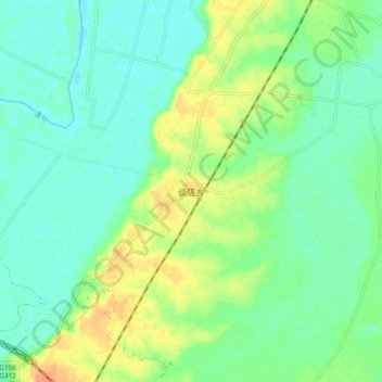
Name: 谈店乡 topographic map, elevation, terrain.
Location: 谈店乡, 潢川县, 信阳市, 河南省, 中国 (32.14364 115.10471 32.22364 115.18471)
Average elevation: 45 m
Minimum elevation: 32 m
Maximum elevation: 70 m
Other topographic maps
Click on a map to view its topography, its elevation and its terrain.