
La Brousse topographic map
Interactive map
Click on the map to display elevation.
About this map
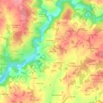
Name: La Brousse topographic map, elevation, terrain.
Average elevation: 334 m
Minimum elevation: 273 m
Maximum elevation: 376 m
Other topographic maps
Click on a map to view its topography, its elevation and its terrain.
La Cellelerie
France > Nouvelle-Aquitaine > Corrèze > Saint-Julien-le-Vendômois
La Cellelerie, Saint-Julien-le-Vendômois, Brive-la-Gaillarde, Corrèze, Nouvelle-Aquitaine, France métropolitaine, 19210, France
Average elevation: 331 m
Lornac
France > Nouvelle-Aquitaine > Corrèze > Saint-Julien-le-Vendômois > Lornac
Lornac, Saint-Julien-le-Vendômois, Brive-la-Gaillarde, Corrèze, Nouvelle-Aquitaine, France métropolitaine, 19210, France
Average elevation: 325 m