
Fairfield topographic map
Interactive map
Click on the map to display elevation.
About this map
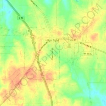
Name: Fairfield topographic map, elevation, terrain.
Location: Fairfield, Freestone County, Texas, 75840, United States (31.69404 -96.20908 31.73893 -96.13276)
Average elevation: 138 m
Minimum elevation: 114 m
Maximum elevation: 158 m
Other topographic maps
Click on a map to view its topography, its elevation and its terrain.
Donie
United States > Texas > Freestone County
Donie, Freestone County, Texas, 75838, United States
Average elevation: 143 m