
芙蓉街道 topographic map
Interactive map
Click on the map to display elevation.
About this map
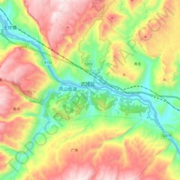
Name: 芙蓉街道 topographic map, elevation, terrain.
Location: 芙蓉街道, 武隆区, 渝东南武陵山区城镇群区位, 重庆市, 中国 (29.25975 107.70642 29.38591 107.88334)
Average elevation: 697 m
Minimum elevation: 164 m
Maximum elevation: 1,378 m