
Thank you for supporting this site ❤️
Make a donation
Make a donation
Samora Correia topographic map
Click on the map to display elevation.
Thank you for supporting this site ❤️
Make a donation
Make a donation
About this map
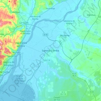
Name: Samora Correia topographic map, elevation, terrain.
Location: Samora Correia, Benavente, Santarém, 2135-297, Portugal (38.77487 -9.02899 39.09487 -8.70899)
Average elevation: 32 m
Minimum elevation: -4 m
Maximum elevation: 339 m
Thank you for supporting this site ❤️
Make a donation
Make a donation
Other topographic maps
Click on a map to view its topography, its elevation and its terrain.