
Dongang topographic map
Interactive map
Click on the map to display elevation.
About this map
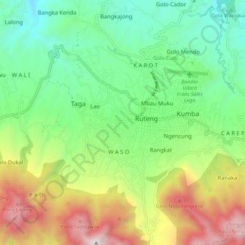
Name: Dongang topographic map, elevation, terrain.
Location: Dongang, Manggarai, Ost-Nusa Tenggara, 86513, Indonesien (-8.65251 120.41666 -8.57251 120.49666)
Average elevation: 1,298 m
Minimum elevation: 723 m
Maximum elevation: 2,340 m