
Aïn Maabed topographic map
Interactive map
Click on the map to display elevation.
About this map
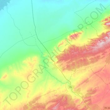
Name: Aïn Maabed topographic map, elevation, terrain.
Location: Aïn Maabed, Daïra Hassi Bahbah, Djelfa, Algérie (34.70816 2.97685 34.96419 3.35386)
Average elevation: 1,006 m
Minimum elevation: 833 m
Maximum elevation: 1,355 m