
Thank you for supporting this site ❤️
Make a donation
Make a donation
Neufahrn bei Freising topographic map
Click on the map to display elevation.
Thank you for supporting this site ❤️
Make a donation
Make a donation
About this map
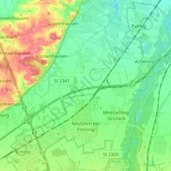
Name: Neufahrn bei Freising topographic map, elevation, terrain.
Location: Neufahrn bei Freising, Landkreis Freising, Bavaria, Germany (48.29025 11.59432 48.37624 11.70534)
Average elevation: 464 m
Minimum elevation: 441 m
Maximum elevation: 514 m
Thank you for supporting this site ❤️
Make a donation
Make a donation
Other topographic maps
Click on a map to view its topography, its elevation and its terrain.