
Banyuasin topographic map
Interactive map
Click on the map to display elevation.
About this map
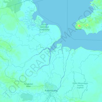
Name: Banyuasin topographic map, elevation, terrain.
Location: Banyuasin, South Sumatra, Indonesia (-3.16112 104.07463 -1.62693 105.57816)
Average elevation: 7 m
Minimum elevation: -3 m
Maximum elevation: 399 m
Other topographic maps
Click on a map to view its topography, its elevation and its terrain.
Pangkalan Panji
Indonesia > South Sumatra > Banyuasin > Pangkalan Panji
Pangkalan Panji, Banyuasin III, Banyuasin, South Sumatra, Indonesia
Average elevation: 16 m