
Mound Haven topographic map
Interactive map
Click on the map to display elevation.
About this map
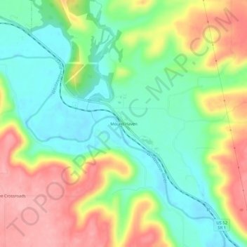
Name: Mound Haven topographic map, elevation, terrain.
Location: Mound Haven, Franklin County, Indiana, 47012, USA (39.36394 -84.99829 39.40394 -84.95829)
Average elevation: 231 m
Minimum elevation: 176 m
Maximum elevation: 306 m