
Schloss Hamborn topographic map
Interactive map
Click on the map to display elevation.
About this map
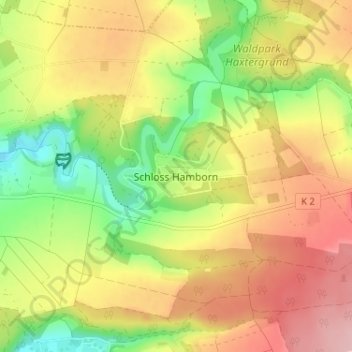
Name: Schloss Hamborn topographic map, elevation, terrain.
Average elevation: 226 m
Minimum elevation: 143 m
Maximum elevation: 305 m
Other topographic maps
Click on a map to view its topography, its elevation and its terrain.
Schloß Hamborn
Deutschland > Nordrhein-Westfalen > Kreis Paderborn > Borchen > Schloss Hamborn
Schloß Hamborn, 1, Schloß Hamborn, Kirchborchen, Schloss Hamborn, Borchen, Kreis Paderborn, Nordrhein-Westfalen, 33178, Deutschland
Average elevation: 214 m