
La Touche topographic map
Interactive map
Click on the map to display elevation.
About this map
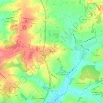
Name: La Touche topographic map, elevation, terrain.
Average elevation: 103 m
Minimum elevation: 64 m
Maximum elevation: 148 m
Other topographic maps
Click on a map to view its topography, its elevation and its terrain.
Le Bourg
France > Nouvelle-Aquitaine > Charente > Anais
Le Bourg, Anais, Confolens, Charente, Nouvelle-Aquitaine, France métropolitaine, 16560, France
Average elevation: 103 m