
Center Ossipee topographic map
Interactive map
Click on the map to display elevation.
About this map
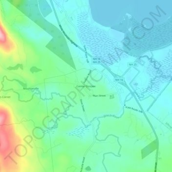
Name: Center Ossipee topographic map, elevation, terrain.
Average elevation: 157 m
Minimum elevation: 120 m
Maximum elevation: 283 m
Other topographic maps
Click on a map to view its topography, its elevation and its terrain.
West Ossipee
United States > New Hampshire > Carroll County > Ossipee
West Ossipee, Ossipee, Carroll County, New Hampshire, 03890, United States
Average elevation: 167 m
Thurley Mountain
United States > New Hampshire > Carroll County > Ossipee
Thurley Mountain, Ossipee, Carroll County, New Hampshire, United States
Average elevation: 386 m