
Hasselburg topographic map
Interactive map
Click on the map to display elevation.
About this map
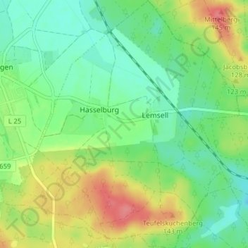
Name: Hasselburg topographic map, elevation, terrain.
Location: Hasselburg, Flechtingen, Börde, Sachsen-Anhalt, Deutschland (52.30379 11.24152 52.34250 11.30242)
Average elevation: 105 m
Minimum elevation: 79 m
Maximum elevation: 149 m
Other topographic maps
Click on a map to view its topography, its elevation and its terrain.
Behnsdorf
Deutschland > Sachsen-Anhalt > Börde > Flechtingen
Behnsdorf, Flechtingen, Börde, Sachsen-Anhalt, Deutschland
Average elevation: 137 m