
Hoher Fläming topographic map
Interactive map
Click on the map to display elevation.
About this map
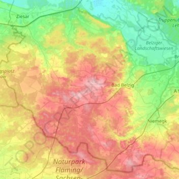
Name: Hoher Fläming topographic map, elevation, terrain.
Location: Hoher Fläming, Potsdam-Mittelmark, Brandenburg, Deutschland (51.98144 12.21585 52.28227 12.74701)
Average elevation: 102 m
Minimum elevation: 33 m
Maximum elevation: 201 m