
Gallipolis Ferry topographic map
Interactive map
Click on the map to display elevation.
About this map
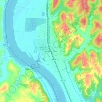
Name: Gallipolis Ferry topographic map, elevation, terrain.
Average elevation: 193 m
Minimum elevation: 164 m
Maximum elevation: 259 m
Other topographic maps
Click on a map to view its topography, its elevation and its terrain.
Leon
United States > West Virginia > Mason County
Leon, Mason County, West Virginia, United States
Average elevation: 184 m
New Haven
United States > West Virginia > Mason County
New Haven, Mason County, West Virginia, 25265, United States
Average elevation: 204 m
Point Pleasant
United States > West Virginia > Mason County > Point Pleasant > Point Pleasant
Point Pleasant, Mason County, West Virginia, 25106, United States
Average elevation: 199 m
Point Pleasant
United States > West Virginia > Mason County
Point Pleasant, Mason County, West Virginia, 25550, United States
Average elevation: 192 m
York
United States > West Virginia > Mason County > York
York, Mason County, West Virginia, 25550, United States
Average elevation: 189 m