
Thank you for supporting this site ❤️
Make a donation
Make a donation
Corry topographic map
Click on the map to display elevation.
Thank you for supporting this site ❤️
Make a donation
Make a donation
About this map
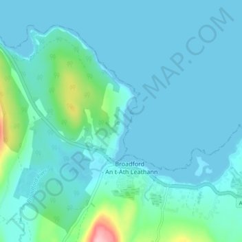
Name: Corry topographic map, elevation, terrain.
Location: Corry, Broadford, Highland, Scotland, IV49 9AA, United Kingdom (57.22867 -5.92880 57.26867 -5.88880)
Average elevation: 19 m
Minimum elevation: 0 m
Maximum elevation: 158 m
Thank you for supporting this site ❤️
Make a donation
Make a donation