
Thank you for supporting this site ❤️
Make a donation
Make a donation
West Laurel topographic map
Click on the map to display elevation.
Thank you for supporting this site ❤️
Make a donation
Make a donation
About this map
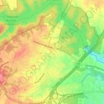
Name: West Laurel topographic map, elevation, terrain.
Location: West Laurel, Prince George's County, Maryland, United States (39.09878 -76.90891 39.13190 -76.87338)
Average elevation: 101 m
Minimum elevation: 53 m
Maximum elevation: 141 m
Thank you for supporting this site ❤️
Make a donation
Make a donation