
La Rochelle topographic map
Interactive map
Click on the map to display elevation.
About this map
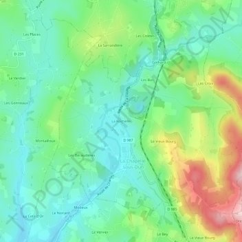
Name: La Rochelle topographic map, elevation, terrain.
Average elevation: 390 m
Minimum elevation: 312 m
Maximum elevation: 565 m
Other topographic maps
Click on a map to view its topography, its elevation and its terrain.
Les Moquets
France > Bourgogne-Franche-Comté > Saône-et-Loire > La Chapelle-sous-Dun
Les Moquets, La Chapelle-sous-Dun, Charolles, Saône-et-Loire, Bourgogne-Franche-Comté, France métropolitaine, 71800, France
Average elevation: 387 m
Gothard
France > Bourgogne-Franche-Comté > Saône-et-Loire > La Chapelle-sous-Dun
Gothard, La Chapelle-sous-Dun, Charolles, Saône-et-Loire, Bourgogne-Franche-Comté, France métropolitaine, 71800, France
Average elevation: 397 m