
Thank you for supporting this site ❤️
Make a donation
Make a donation
Alton topographic map
Click on the map to display elevation.
Thank you for supporting this site ❤️
Make a donation
Make a donation
About this map
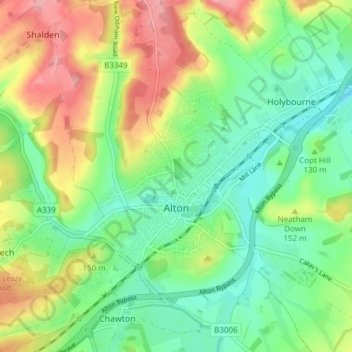
Name: Alton topographic map, elevation, terrain.
Location: Alton, East Hampshire, Hampshire, England, United Kingdom (51.13176 -1.00676 51.17463 -0.93078)
Average elevation: 135 m
Minimum elevation: 90 m
Maximum elevation: 207 m
Thank you for supporting this site ❤️
Make a donation
Make a donation