
Thank you for supporting this site ❤️
Make a donation
Make a donation
Schwabach topographic map
Click on the map to display elevation.
Thank you for supporting this site ❤️
Make a donation
Make a donation
About this map
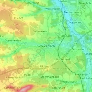
Name: Schwabach topographic map, elevation, terrain.
Location: Schwabach, Mittelfranken, Bayern, 91126, Deutschland (49.28955 10.97951 49.36955 11.05951)
Average elevation: 356 m
Minimum elevation: 302 m
Maximum elevation: 462 m
Thank you for supporting this site ❤️
Make a donation
Make a donation
Other topographic maps
Click on a map to view its topography, its elevation and its terrain.