
Wolstanton Marsh topographic map
Interactive map
Click on the map to display elevation.
About this map
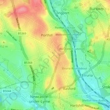
Name: Wolstanton Marsh topographic map, elevation, terrain.
Average elevation: 143 m
Minimum elevation: 111 m
Maximum elevation: 191 m
Other topographic maps
Click on a map to view its topography, its elevation and its terrain.
Betley Mere
United Kingdom > England > Staffordshire > Borough of Newcastle-under-Lyme > Wrinehill > Cracow Moss
Betley Mere, Cracow Moss, Betley, Wrinehill, Borough of Newcastle-under-Lyme, Staffordshire, England, United Kingdom
Average elevation: 81 m