
Park City topographic map
Interactive map
Click on the map to display elevation.
About this map
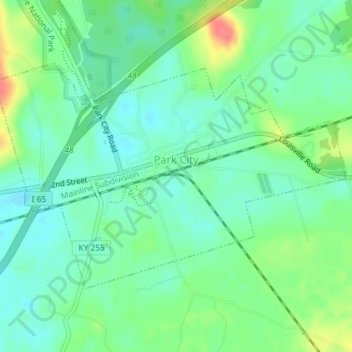
Name: Park City topographic map, elevation, terrain.
Location: Park City, Barren County, Kentucky, United States (37.08333 -86.06508 37.10182 -86.02893)
Average elevation: 201 m
Minimum elevation: 181 m
Maximum elevation: 244 m
Other topographic maps
Click on a map to view its topography, its elevation and its terrain.
Eighty Eight
United States > Kentucky > Barren County
Eighty Eight, Barren County, Kentucky, United States
Average elevation: 241 m
Etoile
United States > Kentucky > Barren County
Etoile, Barren County, Kentucky, 42131, United States
Average elevation: 246 m
Hiseville
United States > Kentucky > Barren County
Hiseville, Barren County, Kentucky, 42152, United States
Average elevation: 221 m
Rocky Hill
United States > Kentucky > Barren County
Rocky Hill, Barren County, Kentucky, United States
Average elevation: 206 m
Austin
United States > Kentucky > Barren County
Austin, Barren County, Kentucky, 42123, United States
Average elevation: 216 m
Glasgow
United States > Kentucky > Barren County > Glasgow > Glasgow
Glasgow, Barren County, Kentucky, 42142, United States
Average elevation: 230 m
Lucas
United States > Kentucky > Barren County > Lucas
Lucas, Barren County, Kentucky, 42156, United States
Average elevation: 197 m
Cave City
United States > Kentucky > Barren County
Cave City, Barren County, Kentucky, United States
Average elevation: 207 m
Glasgow
United States > Kentucky > Barren County
Glasgow, Barren County, Kentucky, United States
Average elevation: 230 m