
Terra Linda topographic map
Interactive map
Click on the map to display elevation.
About this map
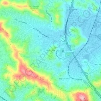
Name: Terra Linda topographic map, elevation, terrain.
Average elevation: 50 m
Minimum elevation: -4 m
Maximum elevation: 201 m
Other topographic maps
Click on a map to view its topography, its elevation and its terrain.
Cerro
United States > California > Marin County > San Rafael
Cerro, San Rafael, Marin County, CAL Fire Northern Region, California, 94903, United States
Average elevation: 58 m
Gallinas
United States > California > Marin County > San Rafael
Gallinas, San Rafael, Marin County, CAL Fire Northern Region, California, 94903, United States
Average elevation: 21 m