
霞浦县 topographic map
Interactive map
Click on the map to display elevation.
About this map
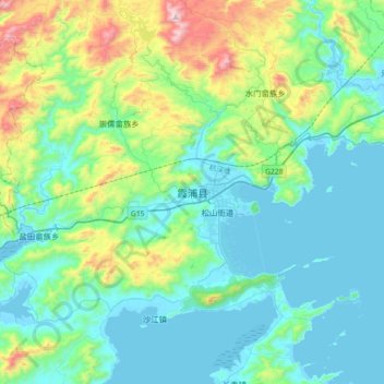
Name: 霞浦县 topographic map, elevation, terrain.
Location: 霞浦县, 宁德市, 福建省, 中国 (26.72853 119.84095 27.04853 120.16095)
Average elevation: 214 m
Minimum elevation: -1 m
Maximum elevation: 1,046 m
Other topographic maps
Click on a map to view its topography, its elevation and its terrain.