
Thank you for supporting this site ❤️
Make a donation
Make a donation
Cawayan topographic map
Click on the map to display elevation.
Thank you for supporting this site ❤️
Make a donation
Make a donation
Cawayan
The locals of Cawayan still largely depend on subsistence farming despite its topographic advantage to adapt commercial farming. The lack of funding for agriculture and infrastructure and its political insecurity due to the presence and activities of armed groups kept by political families[19] and other subversive elements hinder the town's progress in spite of its geographical benefits.
Thank you for supporting this site ❤️
Make a donation
Make a donation
About this map
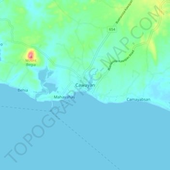
Name: Cawayan topographic map, elevation, terrain.
Location: Cawayan, Masbate, Bicol Region, 5409, Philippines (11.89013 123.72923 11.97013 123.80923)
Average elevation: 12 m
Minimum elevation: -1 m
Maximum elevation: 97 m
Thank you for supporting this site ❤️
Make a donation
Make a donation